Harsh Shinde

Harsh Shinde

GSoC'25 Contributor at OSGeo

Hello! I am a passionate open-source contributor at OSGeo (Open Source Geospatial Foundation).

I'm currently contributing to the OSGeo Foundation as part of Google Summer of Code 2025, where I focus on building tools that make geospatial datasets more AI-ready using standards like GeoCroissant and STAC.

My work lies at the intersection of Earth observation, data-centric AI, and metadata standardization — aiming to bridge the gap between raw satellite data and practical, machine-learning-ready pipelines.

I'm currently working on remote sensing and its applications. I am an open-source developer with experience in Python, Cloud computing, AI/ML, and geospatial technologies. I'm passionate about continuous learning and enjoy exploring new programming languages and tools in my free time.

When I'm not coding, I'm usually exploring new research papers, working on environmental data projects, or experimenting with satellite imagery in Google Earth Engine.

I am currently a final year student pursuing B.Tech in Electronics and Telecommunication at KDK College of Engineering.

Recent News

  • May, 2025: Selected as GSoC Contributor 2025 at OSGeo Foundation, working on geospatial datasets and AI-ready tools using standards like GeoCroissant and STAC.
  • Mar, 2025: Submitted paper "Landslide Detection and Mapping Using Deep Learning Across Multi-Source Satellite Data and Geographic Regions" to JETIR 2025 Journal of Emerging Technologies and Innovative Research.
  • Mar, 2025: Submitted paper "A Comprehensive Approach to Landslide Detection: Deep Learning and Remote Sensing Integration" to IJARCCE 2025 International Journal of Advanced Research in Computer and Communication Engineering.
  • Feb, 2025: Submitted paper "An Exhaustive Review on Deep Learning for Advanced Landslide Detection and Prediction from Multi-Source Satellite Imagery" to JETIR 2025 Journal of Emerging Technologies and Innovative Research.
  • Jan, 2025: Selected as Research Intern at MRSAC, focusing on geospatial technologies, remote sensing, spatial data analysis, and GIS applications.
  • Jan, 2025: Selected for Google Cloud Arcade Facilitator Program Cohort 1 as a Mentor, continuing to guide students in cloud technologies.
  • Aug, 2024: Secured Second Runner-Up position in the prestigious VNIT Geo Spatial AI Challenge organized by ISRO - RRSC, Nagpur!
  • Jul, 2024: Honored to announce selection as an Arcade Facilitator for the 2024 cohort of the Google Cloud Arcade Facilitator program as a Mentor.

Experience

MRSAC | Research Intern

Harsh Shinde | Jan 2025 to Present

Technologies: Geospatial Technologies, Remote Sensing, Spatial Data Analysis, EO, GIS

Role: Analyzing land use/land cover change, urban heat islands, and land surface temperature (LST) variations in the Nagpur region using remote sensing data. Creating building footprint datasets for regions in Turkey through high-resolution satellite imagery and GIS techniques. Detecting farm boundaries using EO data and spatial analysis to support agricultural land mapping and monitoring.

Selected Publications

*See my Google Scholar for a complete list.

Landslide Detection and Mapping Using Deep Learning Across Multi-Source Satellite Data and Geographic Regions

Rahul Burange, Harsh Shinde, Omkar Mutyalwar

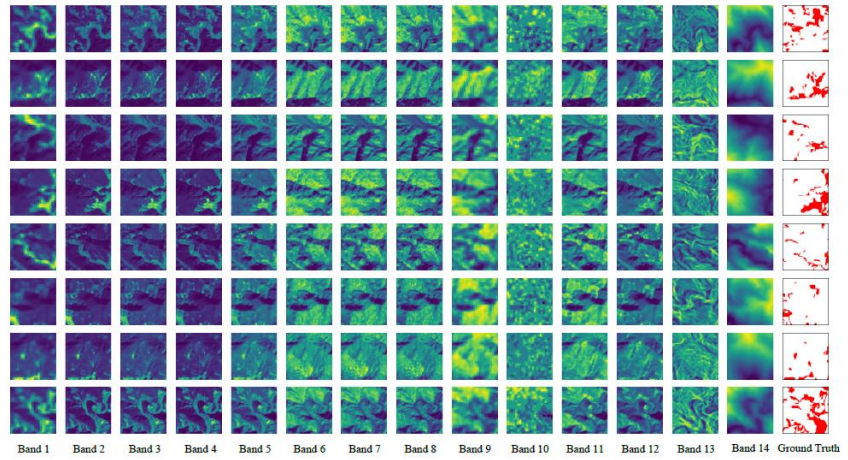
TLDR: This study integrates deep learning with multi-source satellite data for accurate landslide detection across diverse terrains. It evaluates models like U-Net, DeepLabV3+, and ResNet using Sentinel-2 and ALOS PALSAR data to improve prediction and risk management.

Paper Code Poster Dataset

A Comprehensive Approach to Landslide Detection: Deep Learning and Remote Sensing Integration

Rahul Burange, Harsh Shinde, Omkar Mutyalwar

TLDR: This paper presents an integrated approach to landslide detection by combining deep learning techniques with remote sensing data. It emphasizes improved accuracy through multi-source data fusion and advanced neural network models.

Paper

An Exhaustive Review on Deep Learning for Advanced Landslide Detection and Prediction from Multi-Source Satellite Imagery

Rahul Burange, Harsh Shinde, Omkar Mutyalwar

TLDR: This review explores deep learning methods for advanced landslide detection and prediction using diverse satellite imagery sources. It highlights model architectures, data fusion strategies, and challenges in real-world applications.

Paper

Projects

DeepSlide: Landslide Detection and Mapping Using Deep Learning Across Multi-Source Satellite Data and Geographic Regions

Rahul Burange, Harsh Shinde, Omkar Mutyalwar

Description: This study integrates deep learning with multi-source satellite data for accurate landslide detection across diverse terrains. It evaluates models like U-Net, DeepLabV3+, and ResNet using Sentinel-2 and ALOS PALSAR data to improve prediction and risk management.

Paper

Assessment of Urban Heat Island and Land Surface Temperature using Landsat 8 and 9 Satellite Imagery and GIS

Harsh Shinde

Description: Analysis of urban heat island effects and land surface temperature variations using advanced satellite imagery and Geographic Information Systems (GIS) techniques.

Report

Satellite Imagery Semantic Segmentation

Harsh Shinde

Description: Implementation of semantic segmentation techniques for satellite imagery analysis using deep learning approaches.

Kaggle Notebook

Leadership

Google Cloud Arcade Facilitator | Mentor

Harsh Shinde | July 2024 to Present

Role: Mentored and guided 600+ students in Google Cloud Platform (GCP), covering Kubernetes, Cloud Functions, Apigee, Firebase, and core services like compute, storage, and networking. Provided hands-on support with Kubernetes cluster management, serverless Cloud Functions, API management via Apigee, and Firebase integration for scalable applications. Organized events, solved technical doubts, and maintained student engagement through continuous support and motivation.

2024 Certificate 2025 Certificate

Open Source Contributions

Google Summer of Code 2025 - OSGeo Foundation

Harsh Shinde

Project: Building tools that make geospatial datasets more AI-ready using standards like GeoCroissant and STAC. Contributing to the OSGeo Foundation as part of Google Summer of Code 2025, focusing on Earth observation, data-centric AI, and metadata standardization.

GSoC Project OSGeo Profile

Awards

Second Runner-Up on VNIT Geo Spatial AI Challenge organized by ISRO, RRSC, Nagpur

Harsh Shinde, Aditya Singh, Ankit Kirtane

Details: The team secured Second Runner-Up position in the prestigious VNIT Geo Spatial AI Challenge organized by ISRO's RRSC, Nagpur, in August 2024. The trophy and certificates were awarded by Dr. G. Sreenivasan, General Manager of RRSC ISRO. The team was later felicitated at KDK College of Engineering by Principal Dr. V.P. Varghese, Director Dr. A.M. Badar, and Head of AI & DS Department Dr. S.M. Malode.

Project Details: Tree/Orchard Detection and Counting from High-Resolution Satellite Images," focused on detecting and counting individual trees or orchards in very high-resolution datasets using Machine Learning (ML) and Deep Learning (DL) techniques. The competition highlighted the commercial importance of accurately identifying horticultural plantations.

College-Photo NRSC, ISRO-Photo

Academics

B.Tech in Electronics and Telecommunication Engineering

(2021 - 2025) | CGPA: 8.01/10

Karmaveer Dadasaheb Kannamwar Engineering College (KDKCE), Nagpur, India

Thesis